-
 สถานที่ท่องเที่ยว

-
 โรงแรม/ที่พัก

-
 โซเชียล

-
ภาคเหนือ

-
ภาคกลาง

-
ภาคใต้

-
ภาคตะวันออก

-
ภาคอีสาน


-
สถานที่ท่องเที่ยว
ทะเล
หัวหิน เพชรบุรี พัทยา บางแสน เกาะเสม็ด เกาะช้าง เกาะกูด เกาะหมาก เกาะสมุย เกาะพะงัน เกาะเต่า ไร่เลย์ อ่าวคุ้งกระเบน เกาะพีพี เกาะลันตา เกาะพยาม เขาหลัก หมู่เกาะสิมิลัน หมู่เกาะสุรินทร์ เกาะไหง -
จองที่พัก
ภาคเหนือ
ที่พักเชียงใหม่ ที่พักเชียงราย ที่พักแม่ฮ่องสอน ที่พักเพชรบูรณ์ ที่พักนครสวรรค์ ที่พักกำแพงเพชร ที่พักตาก ที่พักน่าน ที่พักพะเยา ที่พักแพร่ ที่พักพิษณุโลก ที่พักลำปาง ที่พักลำพูน ที่พักสุโขทัย ที่พักอุตรดิตถ์ภาคกลาง
ที่พักประจวบคิรีขันธุ์ ที่พักเพชรบุรี ที่พักกรุงเทพฯ ที่พักนครนายก ที่พักกาญจนบุรี ที่พักราชบุรี ที่พักฉะเชิงเทรา ที่พักนนทบุรี ที่พักนครปฐม ที่พักสมุทรปราการ ที่พักสมุทรสาคร ที่พักสมุทรสงคราม ที่พักชัยนาท ที่พักปราจีนบุรี ที่พักลพบุรี ที่พักสระบุรี ที่พักสระแก้ว ที่พักสิงห์บุรี ที่พักสุพรรณบุรี ที่พักอ่างทอง ที่พักอยุธยา ที่พักอุทัยธานีภาคใต้
ที่พักภูเก็ต ที่พักเกาะเต่า ที่พักเกาะพงัน ที่พักเกาะสมุย ไร่เลย์ ที่พักเกาะพีพี ที่พักเกาะลันตา ที่พักเขาหลักกิจกรรม
- บอร์ด
ภาพถ่าย
- โซเชียล
- ติดต่อเรา


 สถานที่ท่องเที่ยว
 โรงแรม ที่พัก
 โซเชียล
ภาคเหนือภาคกลางภาคใต้Hotel Reservation > Mercure Koh Chang

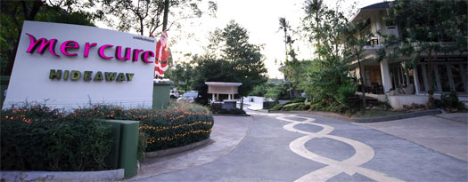
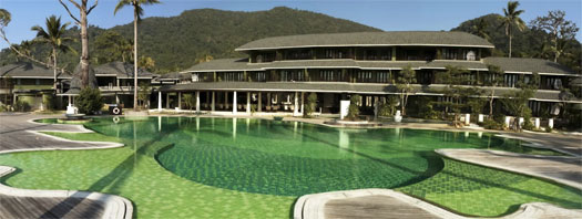
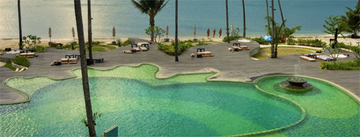
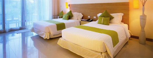
Mercure Koh Chang
Koh Chang District
Map - Mercure Koh Chang
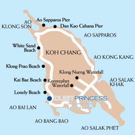
Koh Chang is located in Trat which is Thailand’s eastern-most province, about 315 km from Bangkok. This small province borders on Cambodia with the Khao Banthat mountain range forming a natural demarcation. With 52 large and small offshore islands, long white sandy beaches and unspoiled coral reefs, Trat offers delightful scenery and a tranquil hideout for nature-lovers. The province also serves as a major fruit-growing and fishing area.
Getting to Koh ChangBy Air:Bangkok Airways operates 3 flights daily which is approximately 45 minutes flight time from Suvarnabhumi Airport. Transportation for Bangkok Airways from Trat airport to all beaches is available at additional cost. For more information visitBy Car:Approximately 315 km, or 4-5 hours drive from Bangkok head out of Bangkok on the Rama 9 Road onto the Motorway to Chonburi-Banbueng and turn left onto Banbueng- Klang- Chantaburi – Trat – Koh Chang.Look for the Laem Ngob signboard at the Laem Ngob-Trat junction. Notice there is a PTT petrol station on your left just after a police checkpoint followed by another PTT station exactly 1 km away. This is the Laem Ngob-Trat junction. Turn right to Laem Ngob. This is Highway No. 3156 (Laem Ngob-Sahn Tung Road). You will reach Ao thammachat.From Ao Thammachart which you will see is called Koh Chang Ferry. Here there is a regular car ferry service to the Ao Sapporat.When you came off the ferry at the island, turn right and head for Bai Lan Bay. The resort is on the right hand side on Bai Lan Bay before Bang Bao Fisherman Village.Ferry from Trat to Koh Chang:At Trat we recommend starting of at “Koh Chang Ferry Pier” in Ao Thammachat which takes 30 minutes to arrive Koh Chang Island at Ao Sapparos Pier.The ferry operates from 06:30 a.m. till 07:00 p.m. The ferry departs every ½ hour from November to April and on long weekends. However, it departs every 1 hour between May to September.Other HotelsHotels & Resorts by Regions- Chiangmai
- Chiangrai
- Kampaengpetch
- Lampun
- Lampang
- MaeHongSon
- Nakornsawan
- Nan
- Payao
- Pichit
- Pitsanulok
- Prae
- Sukhothai
- Tak
- Utaradit
- Bangkok
- Angthong
- Ayutthaya
- Chachoengsao
- Chainat
- Kanchanaburi
- Lopburi
- Nakornnayok
- Nakornpathom
- Nonthaburi
- Pathumthani
- Petchaburi
- Prachinburi
- Prachuabkirikhan HuaHin
- Ratchaburi
- Samutrprakarn
- Samutsakorn
- Samutsongkram
- Saraburi
- Singburi
- Srakaew
- Supanburi
- Uthaithani

All rights reserved by thai-tour.com
English: [Thailand Tourist Infomation]
Thai: [thai-tour.com]
เกี่ยวกับเรา | นโยบายความเป็นส่วนตัว | การใช้เว็บไซต์
TAT License 11/04452
รีสอร์ท โรงแรม ร้านอาหาร ร้านค้า บริษัททัวร์ และกิจการอื่นๆ ที่เกี่ยวข้อง
สนใจโฆษณา
ติดต่อ ads@thai-tour.com
โทร.02-1641001-6 ต่อ 301 มือถือ 098-2807098
ติดต่อ
บริษัท ไทยทัวร์ อินโฟ จำกัด
46/26 ถนนเจริญราษฎร์ แขวงบางโคล่ เขตบางคอแหลม กรุงเทพฯ 10120
Office: โทร. 02-1641001-7 แฟกซ์ 02-1641010
Email: info@thai-tour.com


